|
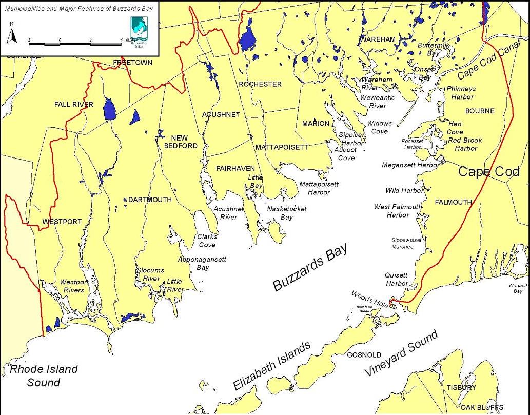
BUZZARDS BAY:
- Is 28
miles long, averages about 8 miles in width and has a mean depth of 36
feet.
- It has
280 miles of shoreline including 11 miles of public beaches.
- It has
30 major harbors and coves.
- Along
its western shore, has seven major rivers and a number of small streams
that flow in to it, including the Westport, Paskamansett, Acushnet,
Mattapoisett, Weweantic, Wankinco and Agawam.
- The
eastern (Cape Cod) shore is drained mostly by groundwater and a few small
streams including the Back, Pocasset, and Wild Harbor Rivers, and Herring
Brook.
- Water
temperatures range from 71.6°F in summer to 28°F in winter. Complete tidal
mixing of Bay water with offshore Atlantic Ocean water is estimated to
occur every 10 days.
THE WATERSHED:
- A
watershed is all the land area that drains to a given body of water. We
all live in a watershed.
- The
Buzzards Bay watershed is 432 square miles in size: twice the size of the
Bay itself.
- Contains
all or large parts of the towns of Westport, Dartmouth, New Bedford,
Fairhaven, Acushnet, Rochester, Mattapoisett, Marion, Wareham, Carver,
Plymouth, Bourne, Falmouth and Gosnold. Smaller parts of Tiverton, Fall
River, Freetown and Middleborough also drain to the Bay.
- 50% of
the Bay watershed is undeveloped and unprotected forestland, farms and
wetlands.
- 25% is
developed for residential, commercial and industrial uses.
- 25% is
protected natural areas.
Approximately 360,000 people live in the
Buzzards Bay watershed.
|